 |
| Lorella Springs homestead camp/bar/camp kitchen |
The couple from Healesville we met on the tip of Cape York told us that we had to stop in at Lorella Springs on our way across The Gulf. Tidbits of information like this is what we live for - there is nothing like a recommendation for a place often not mentioned very often and from people who had actually been there. And so from Lawn Hill we headed west across the border, leaving Queensland behind after being there since February as 'Queenslanders'!
Lorella Springs is still on The Savannah Way, but most people don't do the actual whole length of it and go the easier route south to Cape Crawford and coming onto the Stuart Highway at Daly Waters. We, of course, are not most people and headed north, skimming closer to The Gulf and bringing us to Lorella Springs - a million acres of wilderness park these days, once upon a time run as a cattle station but now just has a measly 10,000 head of feral mickey's running about causing havoc. They muster once a year and Matt is very tempted to go back for 'a holiday' mustering here as the owner offered him, there would be some pretty crazy critters running around in there that hadn't seen people and weren't too keen on being mustered. The bull catchers parked up at the main homestead had poor Matty chomping at the bit!
 |
| Matt 'cooling off' in the thermal hot springs at Lorella, and me atop a rocky outcrop looking over the million acres |
 |
| Guess who was on gates going through station country from Lawn Hill to the border? |
 |
| Stopped to take a photo and a whirly-whirly took off! |
We really didn't know what to expect at Lorella Springs - but we did totally underestimate how much there really was to do. From the main homestead campground (which is pretty nice on the thermal hot springs creek with toilets and showers, light the donkey if you want a hot one) you can travel out into the property and explore the many attractions like waterholes, creeks, billabongs, rocky outcrops and caves. On our second day we went exploring, heading north to do a few walks to creeks and waterfalls which were by this time of the year drying up. We took a dip at 'The Inkspot', a little waterhole on a creek with a rocky ledge you can jump from.


The track continues east for 80km through some fairly big patches of bulldust and twists and turns some places, so the 80km takes about 3 hours until you reach the Rosie Creek fishing camp. Apparently this is a barramundi fisherman's paradise - or so we're told. If you want to catch a barra, this is where to come. Well we aren't mad keen or super expert fishermen/women but we'll give it a go! And a go we did, fishing the billabong driving out to the camp first in a little tinny left there by Rhett, the station owner, for the likes of us to use, and then when we got to Rosie Creek Matt was dead keen on catching a barra. Only problem was nobody else was catching much either, so we didn't like our chances. Some blokes had been there for four days, fishing ten hours a day and had only caught four average size barra by sheer luck. Our chances of throwing in a lure hoping for the best weren't looking so hot.
 |
| Matt fishing on the Rosie Creek |
 |
| Sunset over Rosie Creek |
 |
| Camp at Rosie Creek |
Next morning we thought we had come so close to the waters of The Gulf we might as well continue out over the salt plains and hit the ocean for more fishing. What was meant to be a 600 metre walk from where you leave your vehicle turned into much longer as the tide was a fair way out - walking through salt encrusted muddy sand in the high 30 degree heat wasn't so great but fishing out there was fairly fun. We cast out into the shallows of the mouth of a creek, a few little sharks swimming around my ankles Matt was a little perturbed by! Some blokes we helped who were bogged in the salt plains caught a mud crab and gave it to us for lunch. As it was the only thing we were getting out of the waters we called it a day, headed back to camp and to our mud crab lunch.


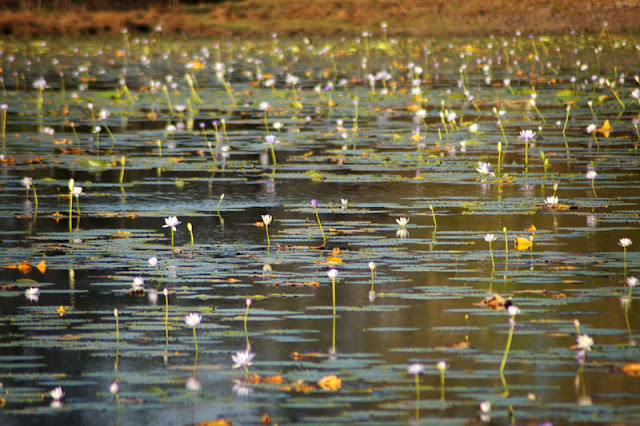
Another night back at the Lorella Springs homestead camp before trekking north towards Roper Bar. We stopped in at the Southern Lost City which was quite amazing - sort of a mini bungle bungles. We camped the night at St Vidgeon's, an abandoned Aboriginal run cattle station, on a beautiful billabong full of waterlillies, birds, jumping fish and crocs I'm guessing!
 |
| The Southern Lost City - was hot! |


Wow loving the photos. They make me want to check it out for myself. Happy travels :)
ReplyDeleteI am quite, quite jealous of your trip.
ReplyDeleteNothing like a muddy for lunch too.
Wow...all so beautiful Emma. Fresh crab for lunch, oh my :)
ReplyDeletesounds fun, and what a pity about the stations that are abandoned or are left to their own devices, TB took such a long time to control up in the top end and who knows what will happen now, with Live Export being almost shut down, how many others will just walk away and cattle left to their own devices...(mind you, mustering the micks would be a great adventure, strap yourself in and take your camera!)
ReplyDeleteoh my - your pics are superb, m'dear. the lotus flowers! xx
ReplyDeleteOh wow, what gorgeous scenery. It sounds like a magical part of our country x
ReplyDelete